


Gulf Oil Spill
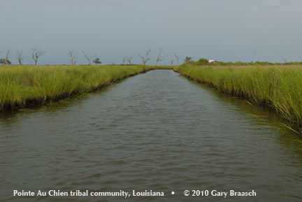
Pointe Au Chien, Louisiana (Aug 15-16, 2010): Channel which was once a two-foot ditch dug as a property boundary near the town. Chucky Verdin and his mother Earline said Indian land had sometimes been bought in the 30s through the 50s by outside land and oil companies in deals which the French-speaking natives thought were just leases.
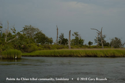
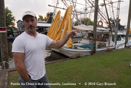
Pointe Au Chien, Louisiana (Aug 15-16, 2010): Tribe Chairman Chucky Verdin points out the broadening channels, dead trees and open water which now dominate tribal land, that in his childhood was much more solid ground. In the 1930s people lived out here south of the present town. He said of the area that was lost to land and oil companies and now to erosion and subsidence, "If we could get it back, I'd take it just the way it is."
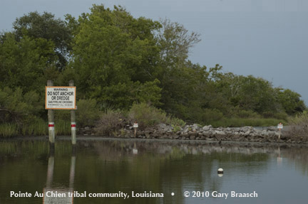
Pointe Au Chien, Louisiana (Aug 15-16, 2010). A bigger issue than the land ditches is the network of oil industry canals and pipelines which have cut the marsh to ribbons and shards. "They were supposed to fill it in after digging the pipelines,' said Chucky. "Also the oil companies put in little dams ... I don't know why ... and then they just left them." The tribe has had to mark them for safety because "if you don't know where they are you could run over them."
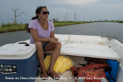
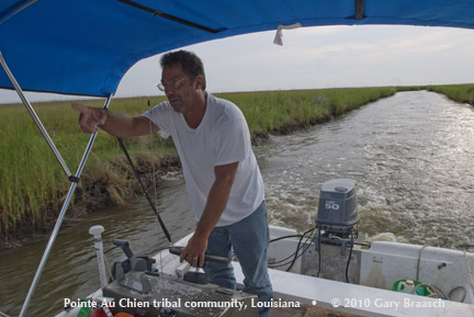
Pointe Au Chien, Louisiana (Aug 15-16, 2010): Christine Verdin in her brother's boat out south of the town. Much of the land she knew as a kid is now subsided or flooded "I'd be lost now because I haven't been out in so long." "These trees were alive when I was younger."
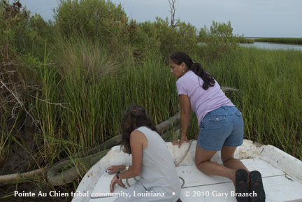
Pointe Au Chien, Louisiana (Aug 15-16, 2010): Christine Verdin and a friend check out an abandoned absorbent oil boom and signs of severe erosion of the marsh, south of Pointe Au Chien, Louisiana. Oil from the BP spill did not enter the town, but was seen in nearby Lake Chien.
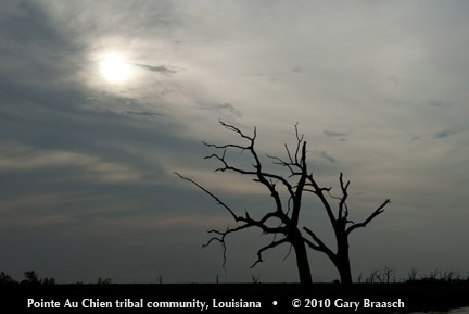
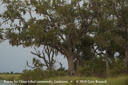
Pointe Au Chien, Louisiana (Aug 15-16, 2010): Some of the oaks which have been killed in recent years by salt water intrusion as the marsh subsides and floods, in large part due to gas and oil development, changes to the Mississippi River flow and erosion from storms. This loss of tribal land and the danger to the village itself, which is being made worse by sea level rise, is the greatest threat to the Pointe Au Chien Indians
Pointe Au Chien, Louisiana (Aug 15-16, 2010) An area study by Robert Morton et al of the USGS says that rapid subsidence and associated wetland loss were largely induced by extraction of hydrocarbons and associated ... water [by the oil industry]. Average historical rates of subsidence between 1965 and 1993 were about 8 to 12 mm/yr, whereas average geological rates of subsidence for the past 5,000 years were about 1 to 5 mm/yr. Natural processes cannot be discounted entirely, the study said..
Pointe Au Chien, Louisiana (Aug 15-16, 2010): A series of apparently ceremonial mounds made by Indians before Europeans came mark the Pointe Au Chien sacred ground south of the town. Trees remain here because of the higher elevation, but the mounds nearer to water are threatened. The mounds are in rectangular groups of four.
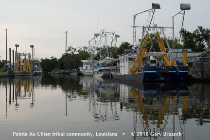
Pointe Au Chien, Louisiana (Aug 15-16, 2010): Shrimp boats in Pointe Au Chien rigged up with booms to work on the oil clean up as Vessels of Opportunity. The tribe convinced BP and its contractor to put a work center at the bayou marina, so most of the men have work on the clean up while fishing has been closed. "The jobs are only temporary," said Chucky Verdin. "We'll have to go back to fishing. But for now most people are going to stay on the job."
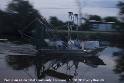
Pointe Au Chien, Louisiana (Aug 15-16, 2010): At dawn on August 16, first day local Louisiana waters were opened again to shrimping, one of only four boats from Pointe Au Chien goes out. Most boat owners remained in harbor getting ready for another day working on the BP cleanup.
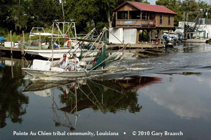
Pointe Au Chien, Louisiana (Aug 15-16, 2010): The shrimping skiff returned from Lake Felicity at the end of the day with 200 pounds of white shrimp which looked clean. But most residents we talked with remained skeptical that the oil was gone and that there would be a market for shrimp. Shrimping everywhere in the Gulf has also become more difficult recently due to huge amounts of imported shrimp.
Pointe Au Chien, Louisiana (Aug 15-16, 2010); Just as the BP - contracted boats were going out on Aug 16, they were called in for the day by BP HQ, the men said. Boat owner Eric Dufrene shrugged, smiled and said " I should've gone fishing." This moment of change for the communities of the Delta -- the oil spill and then the decision to stay with BP or fish when markets are unknown -- is difficult for many people.
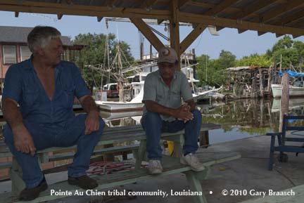
Pointe Au Chien, Louisiana (Aug 15-16, 2010): Jake Billiot, who owns two boats, the Sitting Bull and the Crazy Horse, only put one to work for the BP contractor, Lawson Environmental Services. The payment for boats is $1200-2000 a day depending on the size of the craft, with additional payments for captains and deckhands, and expenses. Those contracted at Pointe Au Chien are only paid if they work (not per month). Jake said, "BP treats us right," about the same money as his normal average shrimping income.
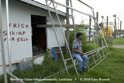
Pointe Au Chien, Louisiana (Aug 15-16, 2010): Price Billiot (l), a shrimp and seafood buyer, talks with Wallace Verdin's brother at his shrimp dock. Price did not open ice house and shop on the first day of in-shore shrimping because so few boats went out. "We'll see if they pull in oil with the nets, he said. He'll probably open by late August when shrimp should be more plentiful. Shrimp prices at the dock have fallen from near $10 a pound in the 80s to $1.20 for jumbos last year, and no more than $3 now.
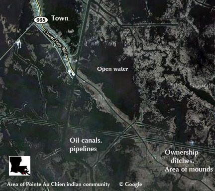
Google satellite map showing the town of Pointe Au Chien, bayou flowing Southeast, the oil canals and pipeline routes, and the area of land ownership ditches and ancient ceremonial mounds.
Photo Reports Intro
1. The BP Deepwater Horizon oil well gushes crude across the Gulf to beaches and marsh.
2. Crude comes ashore from Gulf Shores to Grand Isle.
3. Clean up workers and local people react to the oil.
4. Oil in the marshes greases up birds and sedges; fishing and shrimping are closed.
5. Shrimping and fishing begin to return but long term effects of oil remain.
5A. The toll on animals and birds continues; rescuers take action.
6. Indians Face Oil Spill
7. Indians Face Oil Spill 2
8. The most endangered sea turtle and the Gulf oil spill 1
9. The most endangered sea turtle and the Gulf oil spill 2
![]()
COPYRIGHT NOTICE:
Photography and text Copyright © 2005 - 2017 (and before) Gary Braasch All rights reserved. Use of photographs in any manner without permission is prohibited by US copyright law. Photography is available for license to publications and other uses. Please contact requestinformation@worldviewofglobalwarming.org. View more of Gary Braasch's photography here.