
Kiribati 2011: Reports from the Four-Corners of the Pacific
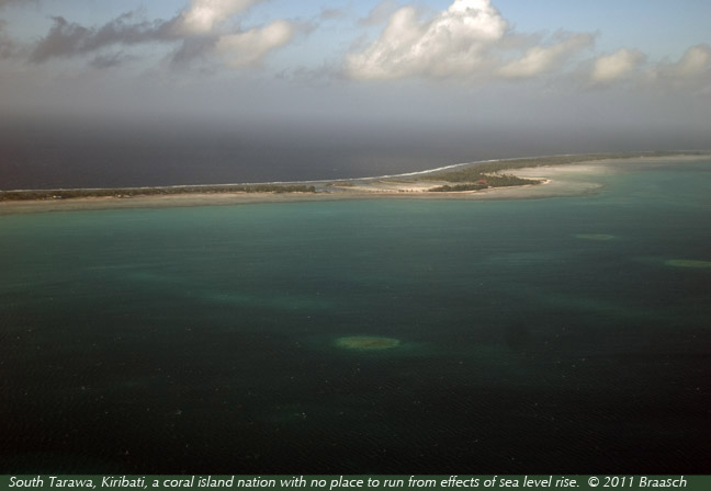
Kiribati is one of the lowest lying nations in the world, and one of the smallest and least industrialized. The nation of 32 coral atolls lies across the "four-corners" of the Equator and the International Dateline, spread across an area of the Pacific Ocean the width of the US. However, its land area is merely 266 sq miles (one quarter the size of Rhode Island) and is no higher in elevation than 3 meters (9.75 feet). The nation consists of the former Gilbert, Phoenix and Line Island archipelagos, and it has been independent from the British Commonwealth since 1978. Its tiny GDP of about $150 million comes from copra (coconut meat) and fishing and it has to import almost everything else it eats and needs for commerce and construction.
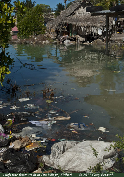
The people of Kiribati are mostly Micronesian and well-educated, speaking English along with native Gilbertese or local island languages. Nearly half of the 100,000 population of Kiribati lives on South Tarawa, the result of a population boom of job-seekers from outer islands in recent decades. Many of these immigrants are now living in the lowest areas and along the shores where tides and storms affect them. The population density on South Tarawa, combinded with poor sanitation, incomplete water distribution and build-up of trash, has created pollution of both ground water and the lagoon. Many of the outer islands are low in population with strong family and village structure, and mostly free of urban issues.
Kiribati, like Tuvalu, the Maldives, Marshall Islands and others, sees increasingly higher tides along its shores due to climate change, and is also subject to stronger storms. These climate threats multiply the ongoing overpopulation, sanitation and water problems on South Tarawa especially.
More photos and information from Kiribati by Gary Braasch for his project World View of Global Warming will be posted here soon. Gary is very grateful for the hospitality, information and good will of Claire Anterea and her family on South Tarawa.
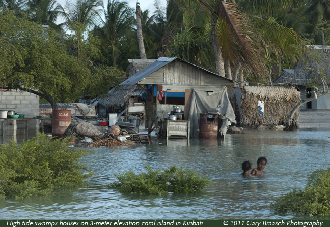
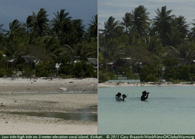
One of the highest tides of the year floods into a neighborhood on South Tarawa, Kiribati, in the village of Eita, where many people live right at sea level.
Although most of the residents have experienced recurring high water for years, more and more are crowding into the lowest areas, and urban problems of pollution, lack of clean water, and trash are multipying.
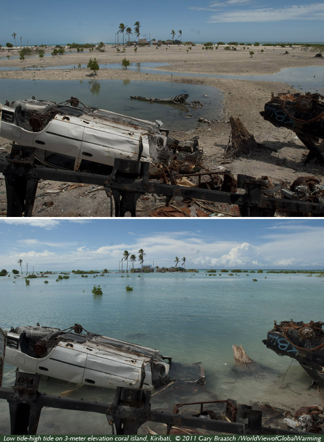
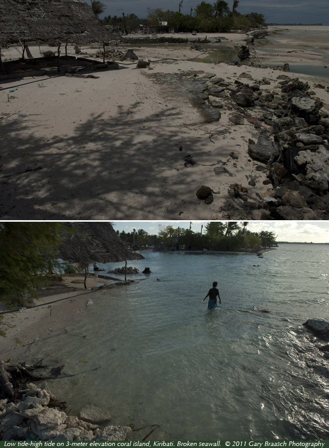
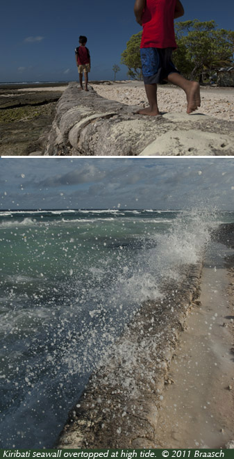
A study published in the journal Weather in 2009 showed the recent sea-level trend for Tarawa was a rise of 3.9 mm per year, a total of 6.1 cm (nearly 2 1/2 in) sea-level rise over 18 years up to September 2008. This is slightly higher than the current estimated world average sea level rise rate of about a foot in a century, which is increasing due to melting of polar ice sheets and glaciers. Higher tides on the gently sloping shores of Kiribati's atolls will bring polluted water, garbage and trash farther into neighborhoods, and increase the destructive power of high waves and storms.
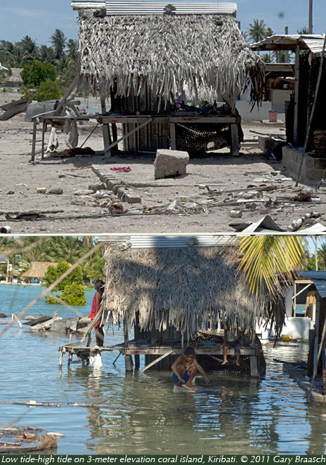
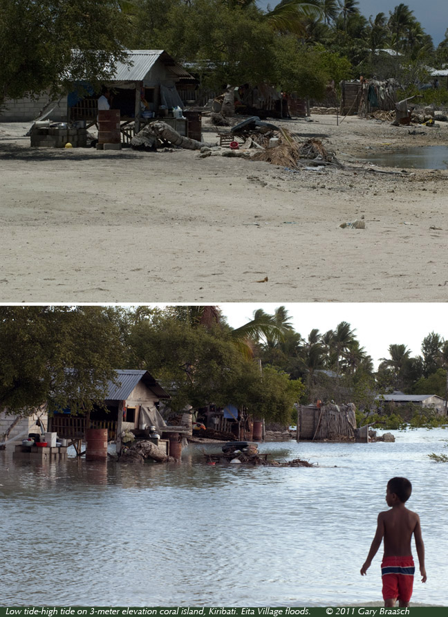
In this portfolio, Gary Braasch shows some of the changes from high to low tides on South Tarawa, on 18-20 March 2011 when the high tides were above 2.8 meters (tide range of more than two meters).
![]()