-
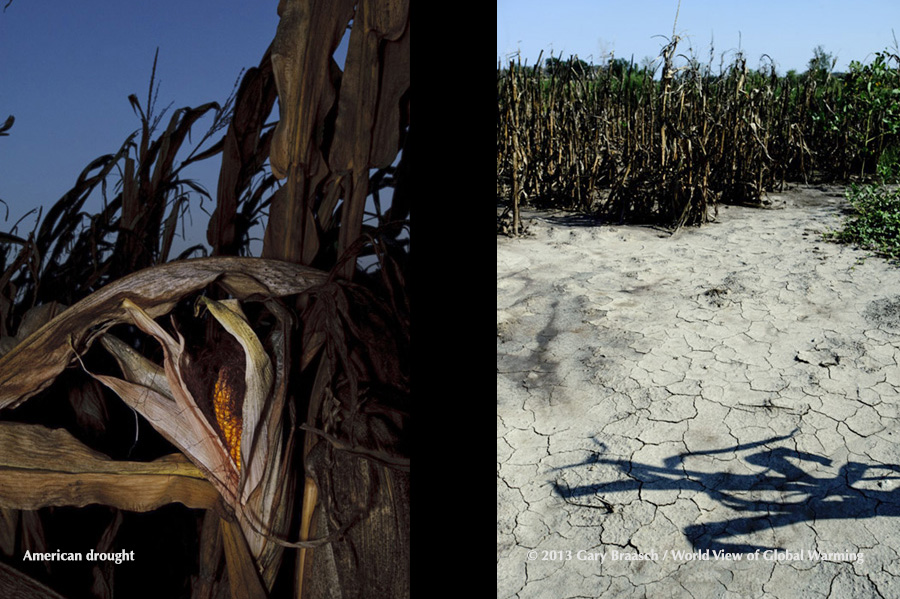
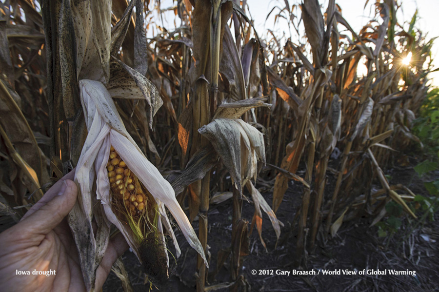 Dissicated corn in Stuart, Iowa. The great American drought of 2012 was the most intense in NOAA records and the most extensive since the 1950s. Corn crop was cut by 13 percent.
-
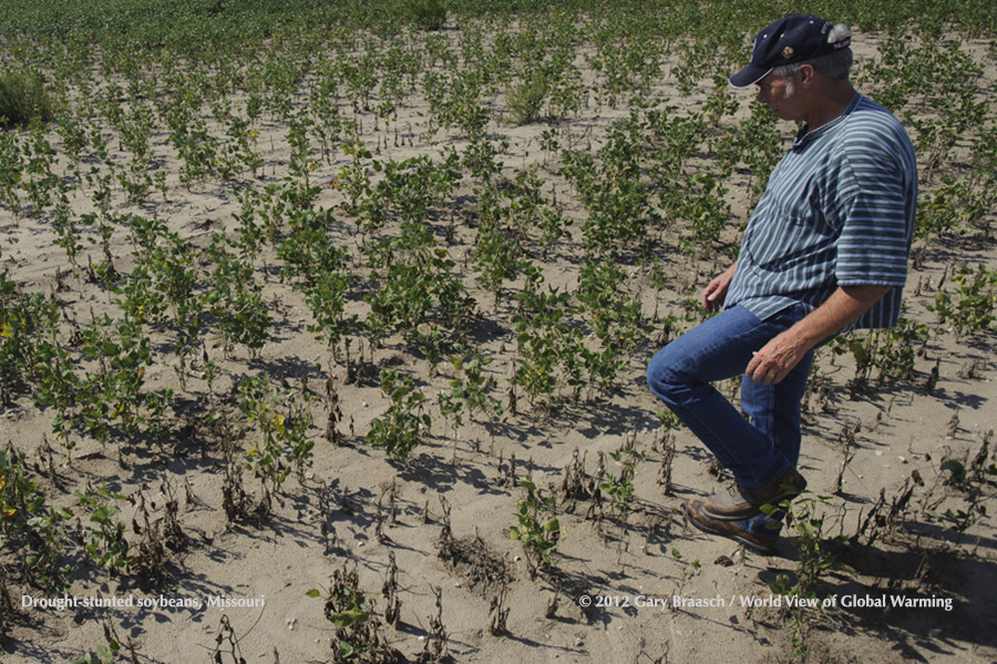 Farmer Rogers Strickland in dissicated soybean field, Weston MO. The great American drought of 2012 was the most intense in NOAA records and the most extensive since the 1950s.
-
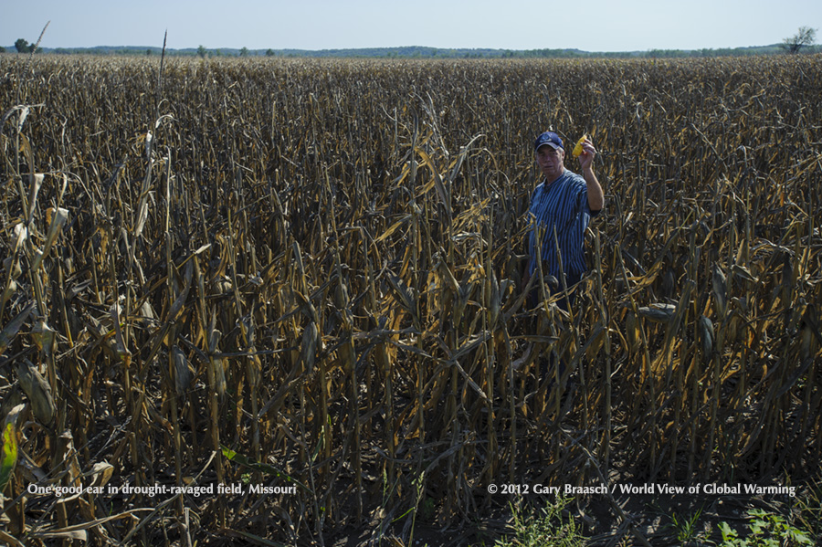 Farmer Rogers Strickland find one good ear in dissicated corn field, Weston MO. The great American drought of 2012.
-
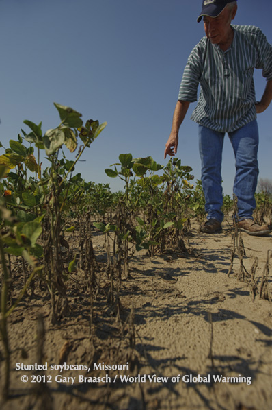 Farmer Rogers Strickland in dissicated soybean field, Weston MO. The great American drought of 2012 was the most intense in NOAA records and the most extensive since the 1950s.
-
 Desiccated cornfield near Victor, Iowa; another near Weston, Missouri. The great American drought of 2012.
-
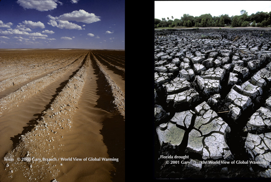 Dry cotton field Texas near Big Springs; dried lake in Orlando Florida, during regional droughts.
-
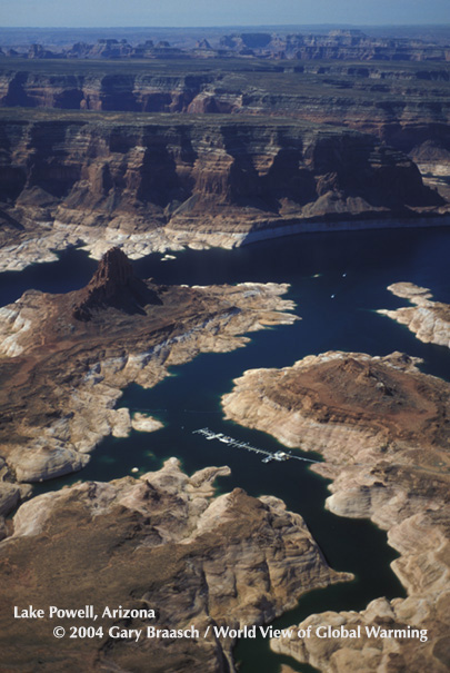 Lake Powell Reservoir during recent recurring ow period ( 2004, at 38% full). Dangling Rope Marina surrounded by "bathtub ring" of low reservoir. Colorado River, Utah and Arizona.
-
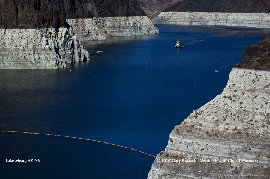 Lake Mead, Colorado River, Nevada and Arizona, losing water rapidly in a long-term drought over the American Southwest. Water level in October 2010 was lowest since Hoover dam built in the 1930s.
-
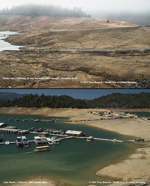 Shasta Lake, California, at Bridge Bay marina, extreme low water in 2014 drought, at about 900 foot water level (65 feet below low photographed in 2007 drought).
-
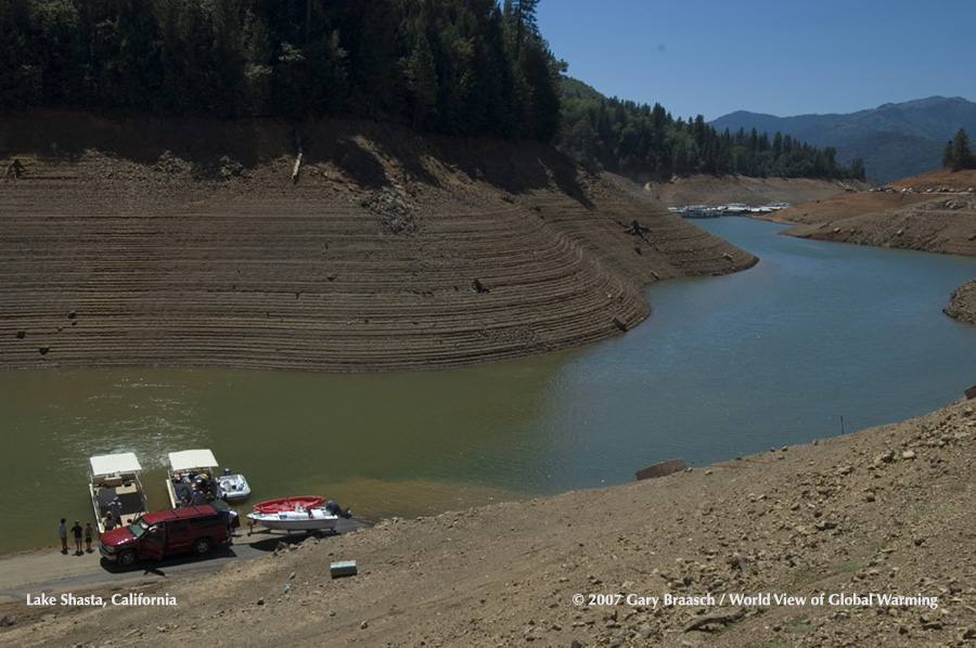 Lake Shasta, California, in 2007 during the previous severe drought before the current one.
-
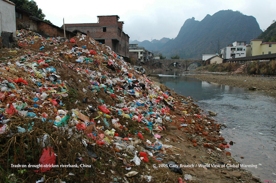 Drought reveals trash dumped in river before water levels fell to record low, Daquo village, Guangdong China. See Asia.
-
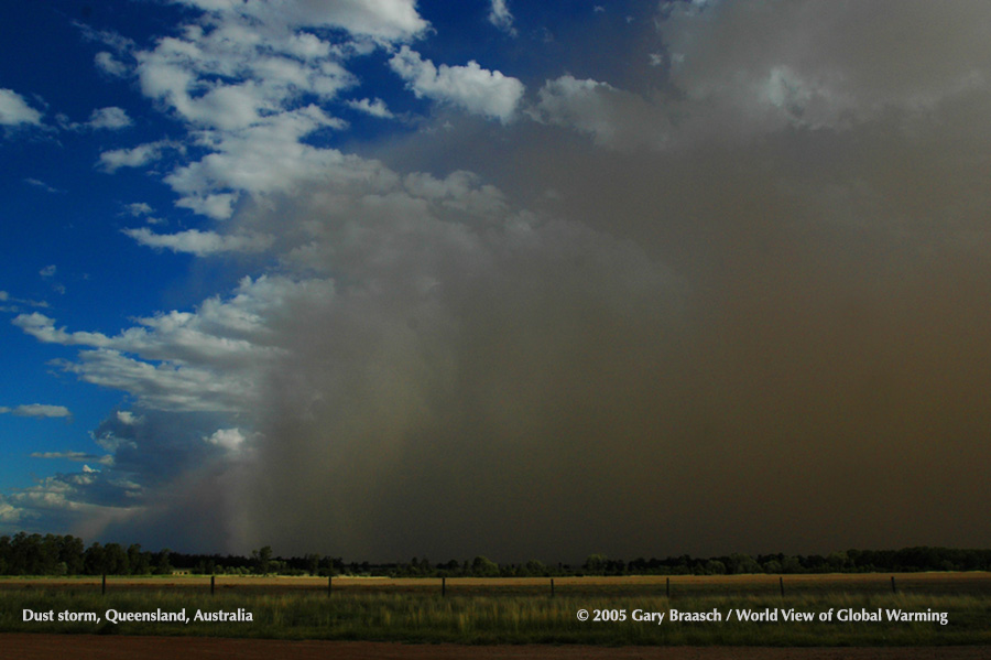 Dust storm blows across Queensland, Australia, Feb 2, 2005. Storm was strongest in decades in the summer, flooded Melbourne, in a preview of recent climate-disrupted weather.
-
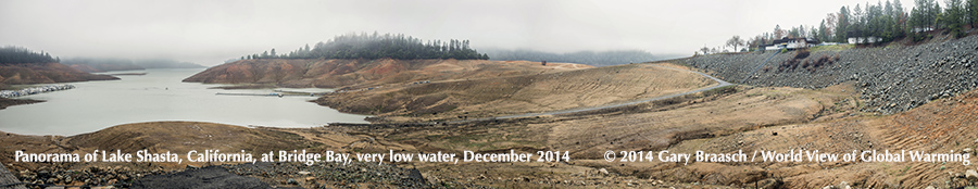 Lake Shasta, northernmost reservoir of the California water system that feeds aquaducts, agriculture and cities, at about 900 ft level in December 2014, near its lowest in the drought. Assembled panorama at Bridge Bay marina..
-
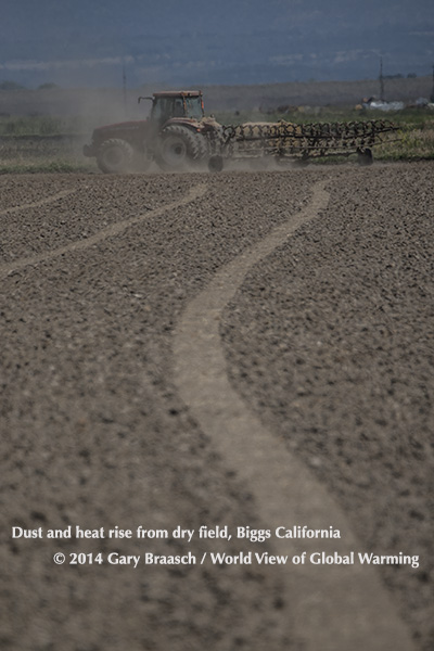 During the California Drought, farmers still prepared fields with liquid fertilizer for vegetables in the Biggs area north of Davis. Heat and dust rise up around tractor. May 2014.
-
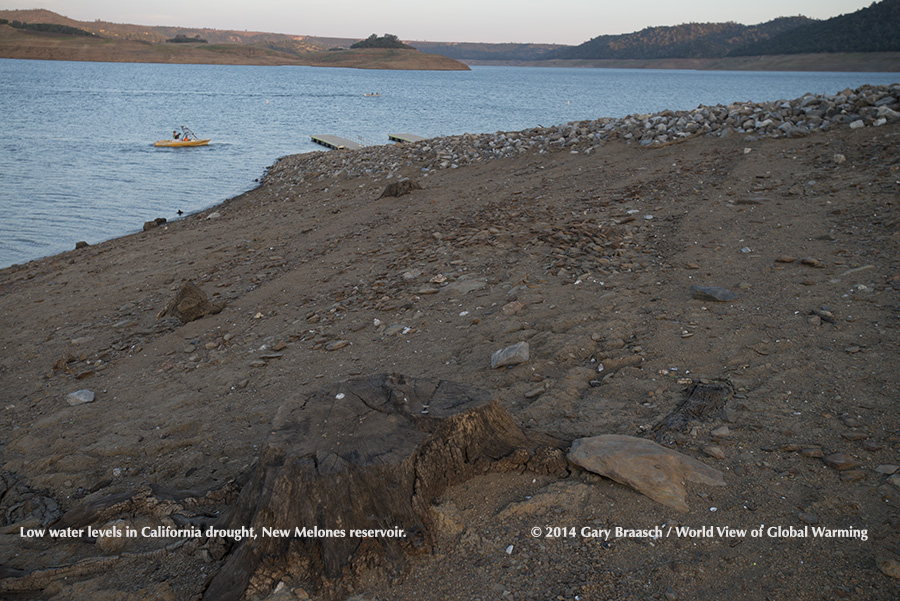 New Melones reservoir, California, holding Stanislaus River water for downstream agricultural use (mainly), is at 40 percent capacity in this May 2014 photograph. See Water.
-
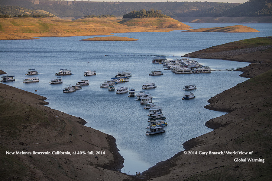 Houseboats crowd together in a shrinking arm of New Melones reservoir on the Stanislaus River, California’s fourth largest empoundment. Water is used primarily for irrigation, some hydropower and recreation. May 2014.
-
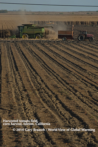 A few tomatoes are left behind after commercial tomato field harvest, feed corn harvest continues near Isleton in the California Delta east of San Francisco.
-
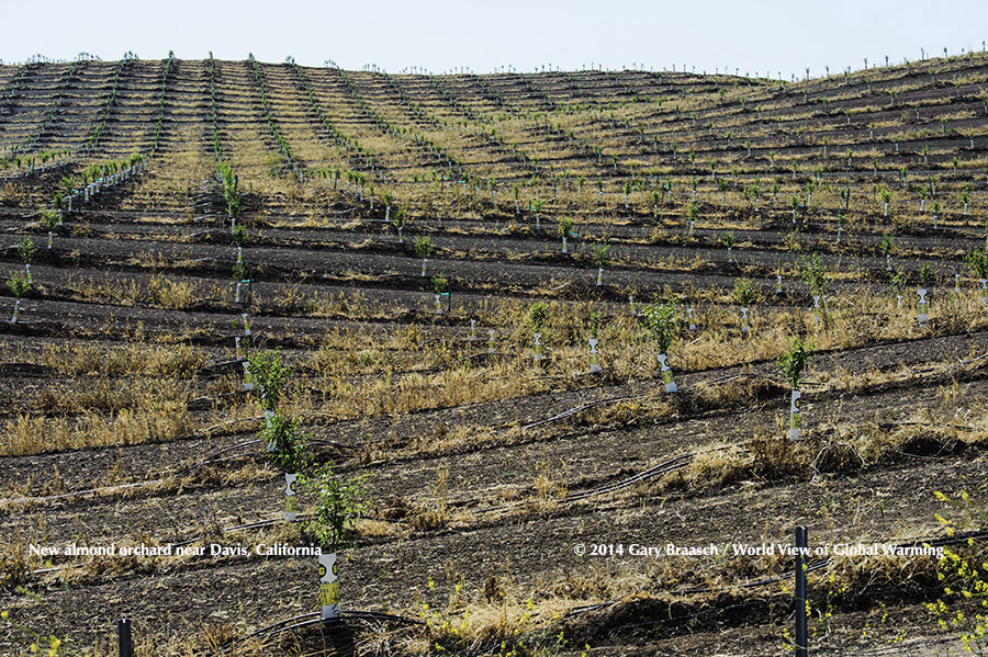 A new almond orchard covers about 2 sq miles of rolling former grassland on I-505 north of Davis, California, part of an expanding market for this nut crop that now uses three times the water that Los Angeles consumes. May 2014
This jQuery slider was created with the free EasyRotator software from DWUser.com.
Use WordPress? The free EasyRotator for WordPress plugin lets you create beautiful WordPress sliders in seconds.
OK
Use WordPress? The free EasyRotator for WordPress plugin lets you create beautiful WordPress sliders in seconds.
OK
Home
For more information and to license images, please contact us.
©Gary Braasch, Photographer PO Box 1465 Portland, OR 97207 USA USA Phone: 503.860.1228